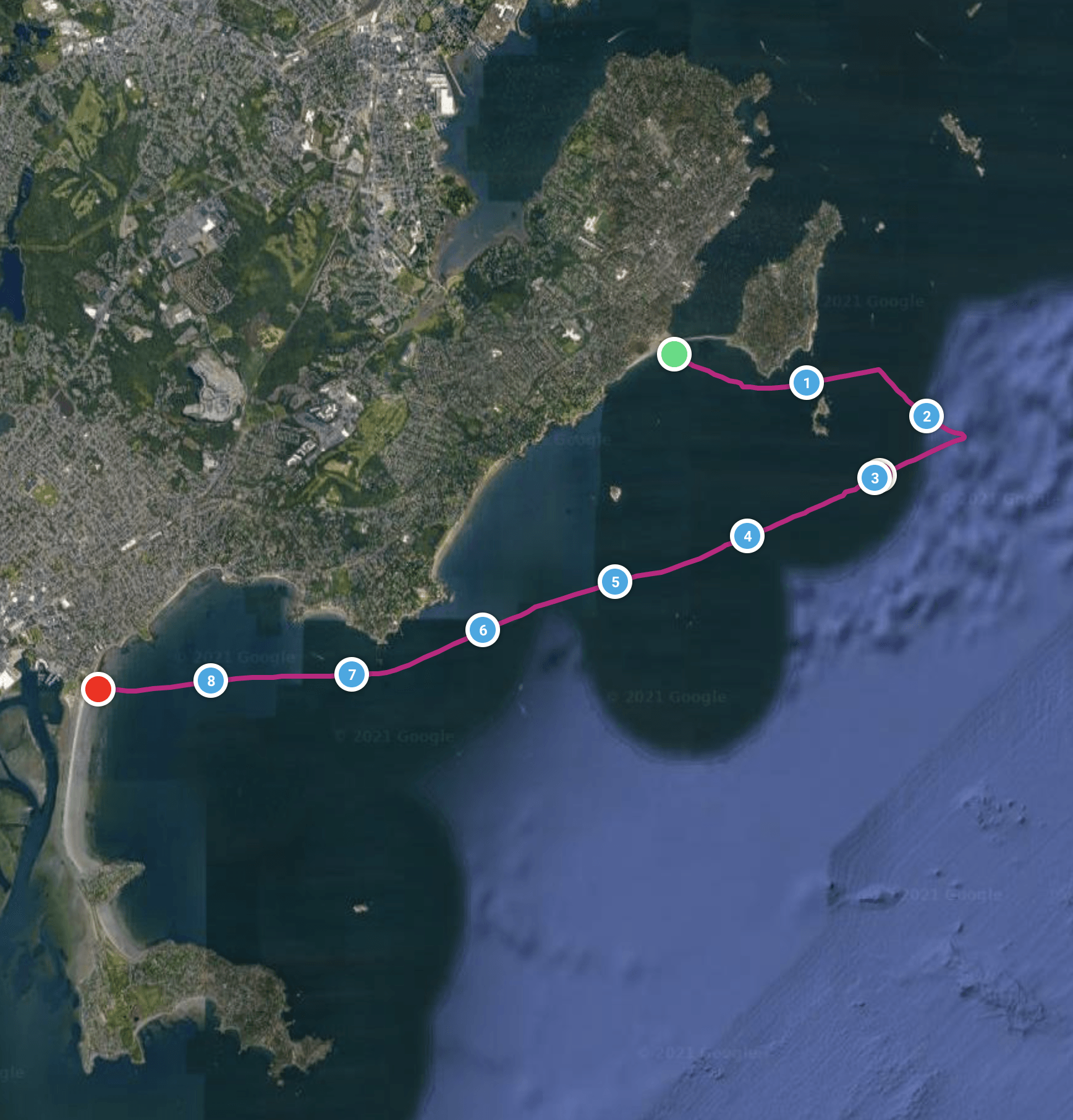
Tinkers Run
Share this run
Start
Devereux Beach, Marblehead, Massachusetts, USA 01945.
https://www.google.com/maps/place/Devereux+Beach/@42.4910865,-70.8612693,15z/data=!3m1!4b1!4m5!3m4!1s0x89e3151e5622cd1f:0xcd513b8763e2c509!8m2!3d42.4911567!4d-70.8569608
Summertime resident sticker and pay-to-park policies in effect by both towns, although drop-offs and pickups are usually fine/free.
Finish
Nahant Beach, Nahant, Massachusetts, USA 01908
https://www.google.com/maps/place/Nahant+Beach+And+Playground/@42.4461794,-70.9400923,15z/data=!4m13!1m7!3m6!1s0x89e36c597439ae91:0xe33d9fd29390a61a!2sNahant+Beach!3b1!8m2!3d42.442095!4d-70.9395773!3m4!1s0x89e36ceb7d48edfd:0x10f4f023f39428aa!8m2!3d42.4560718!4d-70.9362847
nahantbeach.com
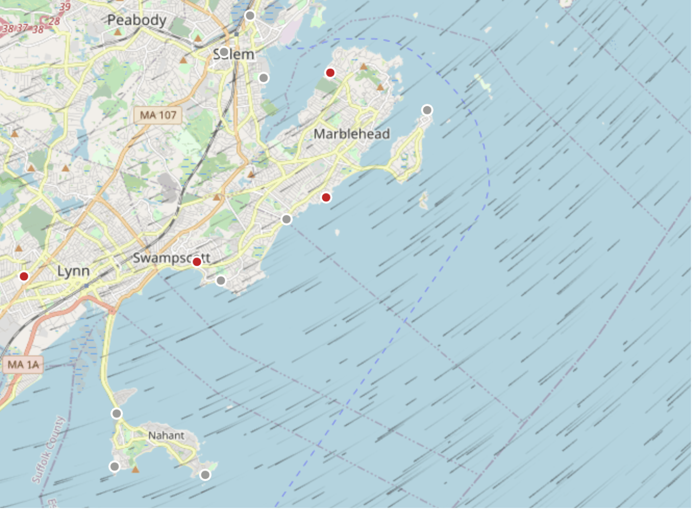
Many paddlers opt to instead drop cars at Fisherman's Beach in Swampscott.
This cuts the shuttle distance from 11k to 6k.
Normally plenty of free parking, especially if the wind is Northeast.
It does add a final ~2k paddle from Nahant to Swampscott to the overall experience.
https://www.google.com/maps/place/Fishermans+Beach/@42.4670646,-70.9109035,18z/data=!3m1!4b1!4m5!3m4!1s0x89e36ca7b3daaab9:0xdc312fd7bc683abe!8m2!3d42.4674001!4d-70.9094922
Run Length
10 km
Shuttle Length
6 km
Weather & More
Note that the 10k distance is measured from the Tinkers Rock gong buoy and not from the Devereux Beach put-in.
There is an initial upwind leg from beach to buoy approximately 3k -- it is not always possible to get out to the buoy for the full run due to conditions.
Ideal: Northeast wind 15-20mph, ENE swell 4-6ft, incoming tide @ halfway.
Contributor
Matt Drayer